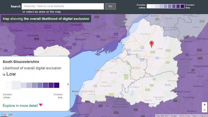
Launched in October 2015, the digital exclusion heatmap shows the likelihood of digital exclusion across the UK at a local authority level. The heatmap was originally developed for Go ON UK with support from the BBC, the Local Government Association and The London School of Economics and Political Science. The product is now owned and maintained by The Tech Partnership, a network of employers collaborating to create the skills needed for the UK digital economy.
Using open source data provided by leading agencies including the Office for National Statistics, Ofcom and HM Revenue and Customs along with insight into basic digital skills in association with Lloyds Bank Group, the heatmap ranks the likelihood of digital exclusion on a 9-point scale, with 9 being the highest likelihood of digital exclusion.
For South Gloucestershire the map predicts the likelihood of digital exclusion to be low, based on a combination of digital and social metrics. These digital metrics include infrastructure, the number of people who have never been online, basic digital skills and how those skills are used. The social metrics include age, education, income and health. Many of these metrics can also be viewed on their own individual heatmaps.
The content of the heatmap tool is to be updated very shortly using 11 updated data sets so watch this space. To find out more visit https://www.thetechpartnership.com/basic-digital-skills/about-the-digital-exclusion-heatmap/ Note that you may need to disable any pop-up blockers in your browser to use the maps.


